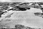


Aerial photography of Saskatchewan is especially unique because of the intricate patterns of crops, waterways, moraines, drumlins, eskers, and glacial spillways.
| The Shield, Forests, and Waterways | Mines, Dams, and Power Stations | Communities | Artistic Interpretations |
“The prairie landscape so often proves to be defiantly irreducible – the flat cannot be made flatter, not the infinite less mysterious. As is usually the case with all forms of art, the cause for excitement lies not in absolute success but in the dimensions of the attempt.”
~ Laurence Ricou
 |
 |
 |
| 256. Water Runoff | 257. Aerial view of Camsell Portage | 258. Aerial view of Camsell Portage |
 |
 |
 |
| 259. Aerial view of Shoal Lake | 260. Aerial view of Shoal Lake | 261. Aerial view of Shoal Lake |
 |
 |
 |
| 262. Aerial view of Wollaston Lake | 263. Aerial view of Denare Beach | 264. Aerial view of Dore Lake |
 |
 |
 |
| 265. Aerial view of Kinoosao | 266. Aerial view of Sled Lake | 267. Aerial view of Green Lake |
 |
 |
 |
| 268. Woodcock Falls | 269. Falls on Fond du Lac River | 270. Boreal forest |
 |
 |
 |
| 271. Northern River | 272. La Loche River | 273. Creek near Montreal Lake |
 |
 |
 |
| 274. Clearwater River | 275. Clearwater River | 276. McFarlane River |
 |
 |
 |
| 277. Churchill River | 278. Birch Rapids | 279. Twin Falls |
 |
 |
 |
| 280. Nistowiak Falls near Stanley Mission | 281. Peter Pond Lake near Buffalo Narrows | 282. Spring Ice on Lac La Ronge |
 |
||
| 283. Sunset over Lac La Ronge |
| The Shield, Forests, and Waterways | Mines, Dams, and Power Stations | Communities | Artistic Interpretations | Top |
“O, the prairie. I cannot describe to you our first impressions. Its vastness, dreariness, loneliness is appalling...the last 15 hours travelling have been like the sea on a very smooth day, without beginning or end.”
~ Mary Georgina Hall.
 |
 |
 |
| 284. Gunnar Mine near Uranium City | 285. Rabbit Lake mine near Wollaston Lake | 286. Key Lake uranium mine |
 |
 |
 |
| 287. Rapid River Dam near Lac La Ronge | 288. Island Falls power station near Sandy Bay | 289. Island Falls power station on Churchill River |
| The Shield, Forests, and Waterways | Mines, Dams, and Power Stations | Communities | Artistic Interpretations | Top |
All skylocked, this enormous flatness holds
Like a prehistoric beast a long machine
Angularly unheroic.
~ Peter Stevens, “Saskatchewan”
 |
 |
 |
| 290. Experimental farm at Cadillac | 291. Aerial view of Beauval | 292. Aerial view of Beauval |
 |
 |
 |
| 293. Aerial view of Cumberland House | 294. Aerial view of Cumberland House | 295. Aerial view of LaRonge |
 |
 |
 |
| 296. | 297. Molanossa - 1971 | 298. Aerial view of Pelican Narrows |
 |
 |
 |
| 299. Aerial view of Pelican Narrows | 300. Aerial view of Uranium City | 301. Aerial view of Montreal Lake |
 |
 |
 |
| 302. Aerial view of La Ronge | 303. Aerial view of La Ronge | 304. Aerial view of Missinipe on Otter Lake |
 |
 |
 |
| 305. Dene community of Patuanak on Churchill River | 306. Metis community of Beauval on Beaver River | 307. Dene community of La Loche |
 |
 |
 |
| 308. Cree community of Stanley Mission | 309. Cree community of Stanley Mission | 310. Dene Village of Dillon |
| The Shield, Forests, and Waterways | Mines, Dams, and Power Stations | Communities | Artistic Interpretations | Top |
 |
||
| 311. Sketch titled - Air View S Sask River |
Previous - Floral Life | Next - Living Skies