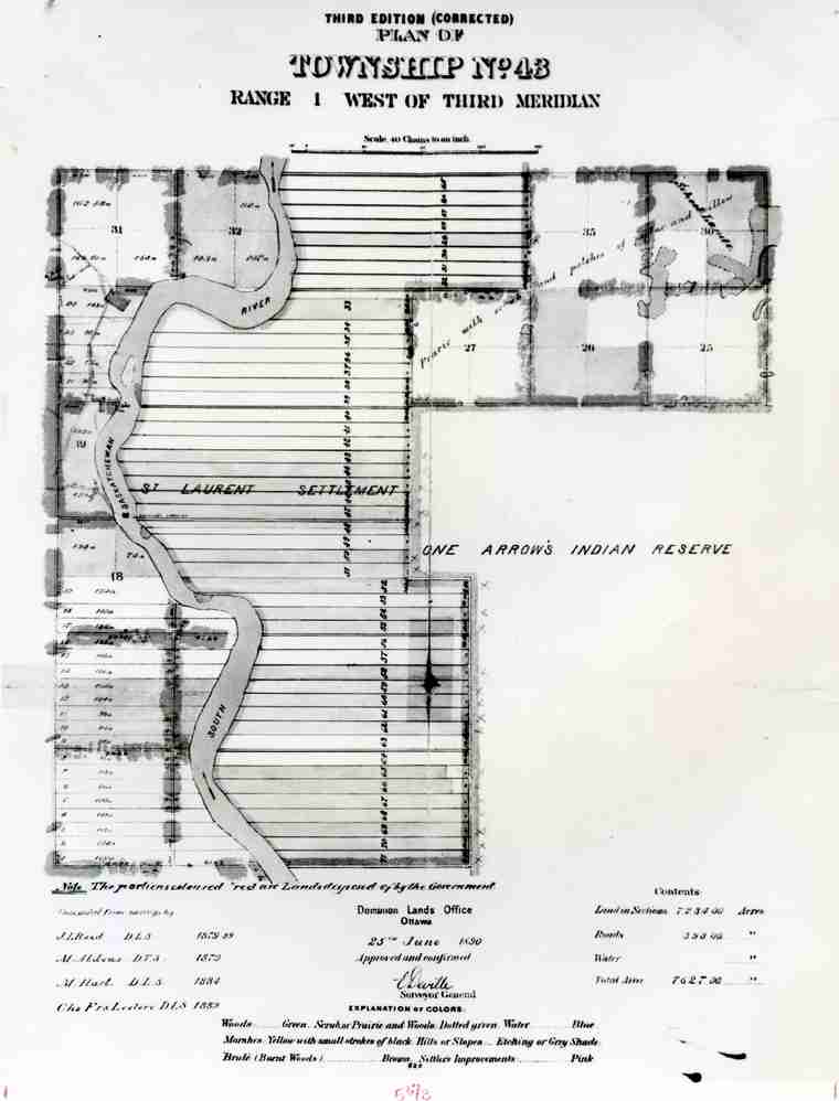
Township Plan of Township 43 (St. Laurent-Batoche area)
 | ||
| Database ID | 27033 | |
| Institution | Saskatchewan Archives Board | |
| Fonds/Collection | Saskatchewan Archives Board Photo Collection | |
| Series | S-B | |
| File/Item Reference | S-B-6500 | |
| Date of creation | 1890 | |
| Physical description/extent | 1 photograph; 19.5 x 25 | |
| Number of images | 1 | |
| Scope and content | Township Plan of Township 43, Range 1, West of the Third Meridian showing St. Laurent Settlement and the Batoche Ferry Crossing. Also shows location of plots relative to the One Arrow Indian Reserve. | |
| Restrictions on access | See Saskatchewan Archives Board | |
| Copyright holder | Unknown | |
| Copyright expiry date | Unknown | |
| Type | Archival | |
| Primary Media | Photographs | |
| Provenance Access Point | Saskatchewan Archives Board Photo Collection | |
| Language of material | English | |
| Place | St. Laurent-Grandin, Saskatchewan, Canada Batoche, Saskatchewan, Canada | |
| Treaty boundaries | Treaty 6 | |
| Cultural region | Plains | |
| Subject | Community Maps Community Histories Metis -- Communities Metis -- History Metis -- Farms Reserves -- Limits Northwest Resistance | |
| Date Range(s) | 1890-1899 1880-1889 | |
| Permanent Link | https://digital.scaa.sk.ca/ourlegacy/permalink/27033 |
|