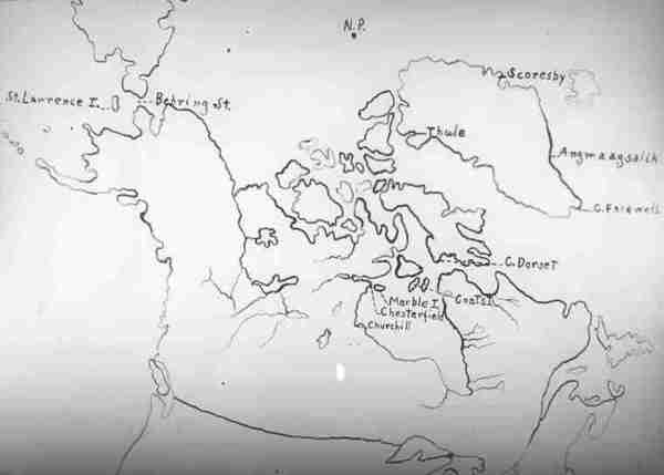
Repository: University of Saskatchewan Archives Fonds/collection: Department of Physics fonds Title of file/item: Hand-drawn map. Creation dates: [1932-1933] Extent: 1 slide Scope and Content: Showing location of Churchill, Chesterfield Inlet, Marble Island, etc. File/item reference: Photographs Box 2 - C-21 Number of scanned pages: 1 Subjects:
Community maps Geography - Maps and borders Scientific research